

The Triangle Should Turn Flood Risk Into Opportunity
BIGGER PICTURE | Creekside development would make the Triangle safer, more connected, and more alive.
There’s just something magical about a city at the water’s edge; yet that’s almost entirely lacking in the Triangle. Long ago, our cities and towns were founded away from water: Chapel Hill famously crests a hill, Raleigh infamously sits in Joel Lane’s tavern’s backyard. Durham, Cary, and Apex began as way stations at a time when railroads frequently followed ridge lines. Only Hillsborough has a (very) small slice of Eno River waterfront, which later fostered a mill.
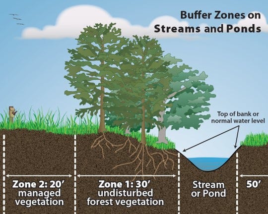
But even all those years ago, foresighted planners laid the groundwork for the Triangle’s many miles of greenways, most of which sit within creek valleys. These greenways preserve public access to the water’s edge, but come with strings attached: the state’s riparian buffer requirements in the Neuse and Jordan Lake basins (i.e., most of the Triangle) make it nearly impossible to build anything except a trail within fifty feet of streams, lakes, reservoirs, ponds, and estuaries.
These rules are a boon to local water quality; they prevent pollutants from flowing into streams and protect aquatic habitats. However, these same rules make it nearly impossible to have a waterfront restaurant or buildings that open out onto streamside greenways.
Keep reading with a 7-day free trial
Subscribe to CITYBUILDER to keep reading this post and get 7 days of free access to the full post archives.